Church Norton
Pagham Harbour
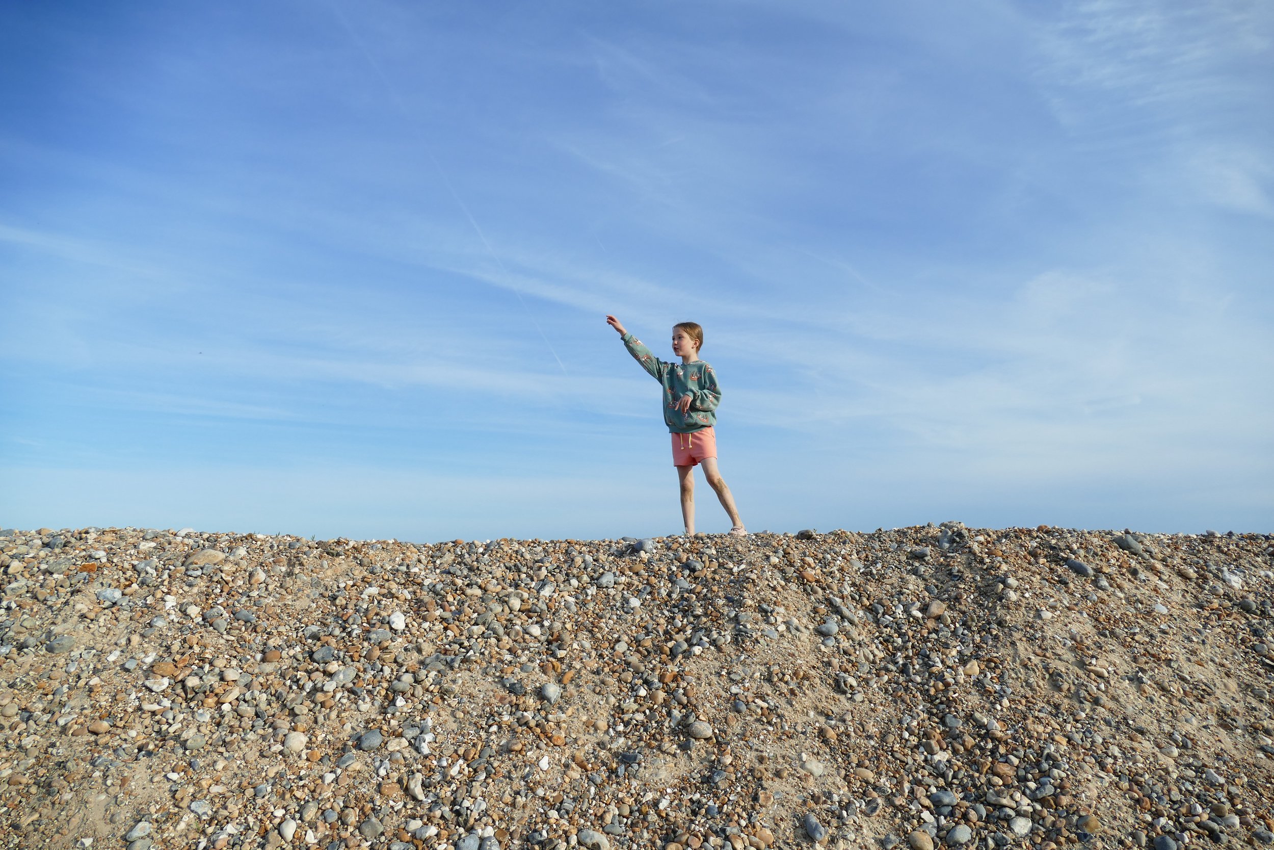
Children will love a huge, and mostly empty, beach on this walk.

East Beach is a quiet beach
The Basics
Time: 40 mins
Distance: 2.5 km
Terrain: Firm shingly paths, flat grassy field, farm tracks and quiet country lanes.
Pushchair: Yes.
Dogs: Dogs are welcome under close control.
Refreshments: None, but bring a blanket and have a picnic on the beach, or see option to walk to RSPB visitor centre.
Toilets: There are no toilets at Church Norton, but there are toilets during opening hours at the RSPB visitor centre.
Public Transport: There is no public transport to Church Norton, but the 51 Link service from Chichester Bus Station to Selsey stops outside the RSPB Visitor Centre. You can walk from there to Church Norton - reverse route below.
Parking: Parking is in a small car park at Church Norton for the beach loop, £2 up to four hours, £3 for over, PayByPhone (Postcode: PO20 9DT - W3W: caveman/nowadays/agency).

A stretch of boardwalk between Church Norton and RSPB Pagham Harbour
Pagham Harbour is a nature reserve on one of the few undeveloped stretches of the Sussex coastline. It is a wildlife haven and contains important habitats for birds, and even seals can sometimes be spotted lying on the shingle beaches. Church Norton sits on the edge of the harbour where you will find St Wilfred’s, a small rural chapel. Our route loops around the beach, church and hamlet with an optional extra to extend the walk to the RSPB visitor centre.
The Route
For a short route that a decent pushchair can handle, use the following directions for a loop around the hamlet of Church Norton. You will see views, birdlife, possibly seals if you are super lucky, the shingle beach and as a random extra, a farm that has some old vehicles parked up that some children might like to see, including two fire engines and a crane! There are no toilets or refreshments for the loop.
Park at Church Norton car park, where you can also visit the chapel. Then follow the straight path down towards the harbour. Turn right when you arrive.
This path will take you out of the harbour to the large shingle beach. The water quality here has been rated as excellent. The path continues along the top of the beach and is framed by wild plants on either side. When you reach a footpath finger post, turn right away from the beach.
This path will soon take you along the right hand side of a field. At the end of the field, turn right towards Greenlease Farm. It is here that you will spot an intriguing vehicle graveyard including a fire engine parked in front of the farmhouse. Continue straight along the farm track, passing other properties until you get to the road.
At the road, turn right. This is the quiet country lane that you will have driven down to get to the car park. Walk down it to return to your car.
If you want a longer walk that explores more of the Pagham Harbour scenery, it is an easy linear walk to the RSPB visitor centre. This route is not pushchair friendly and will take you about 1.5 hours there and back. At the visitor centre, you will find toilets, picnic tables and light refreshments such as hot drinks, biscuits, crisps and ice-cream. There are usually guides on hand to talk you through any wildlife that is around and you will walk past two bird hides and a pond.
From the Church Norton car park, follow the straight path down to the harbour. Turn left when you arrive.
You will initially walk over a series of slim boardwalks before hitting the coastal path. The path follows the shore and then nips up higher behind hedges before descending again. There is only one path, so it is pretty easy to follow - just keep the harbour to your right.
The path will eventually bring you up to the road, where you should veer right and follow the signs for the RSPB visitor centre. You will pass Ferry Hide and then can either chose to walk through the Discovery Zone, where there is a pond and other wildlife habitats to explore (no dogs), or go straight to the visitor centre.


Did you know?
Selsey translates from the old Anglo-Saxon as ‘seal island’.
Look out for tern island, a man made raft used as a suitable nesting site for terns. You will hear them as they feed around the harbour and can catch up with their nests on live-web cams.
The chapel was once a full sized church, until part of it was demolished and rebuilt at the centre of the village. The chancel is the only part still standing in its original location.
No buildings over a certain height are allowed to be built on Manhood Peninsula so as to preserve the views of Chichester Cathedral - the only cathedral in England that you can see from the sea!
If you liked this walk…
Try this one at Climping Beach, beween Bognor Regis and Littlehampton. It also has an undeveloped section of coastline.
We are passionate about keeping The Ambling Path as a free resource available to everyone, forever. If you have enjoyed using our walking guides, then please consider leaving us a donation. This will help to cover our costs as well as rewarding the considerable time and effort needed to maintain the site. Thank you.
Follow us on social media to see our new walks and get regular updates on our old ones: